
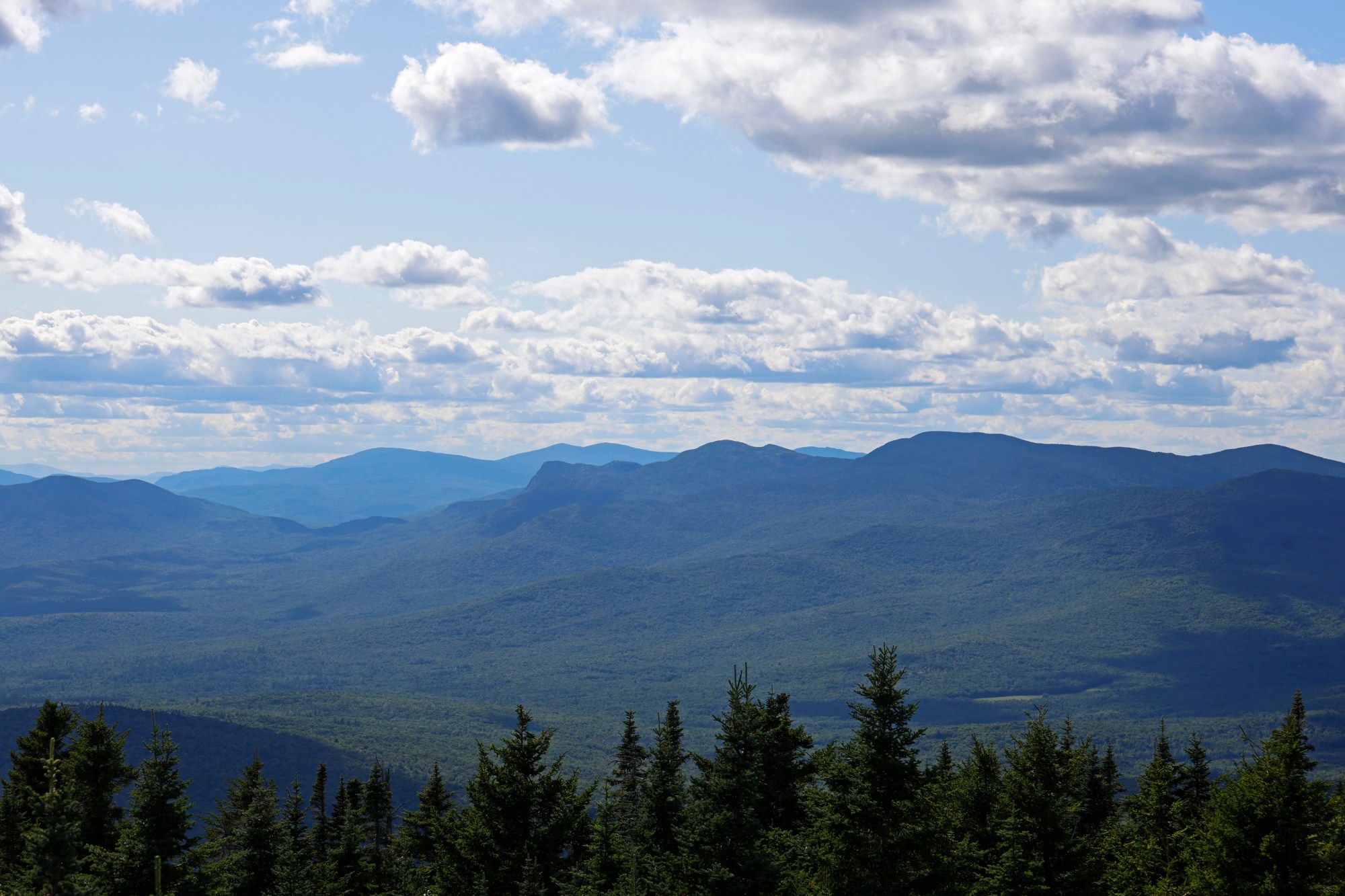
While Maine’s days of fire towers may have ended decades ago, mountains across the state still hold the lookouts for hikers with the energy to seek them out.
New Hampshire has a challenge to visit five of the 15 fire towers in that state. With 15 of its own, maybe it’s time for Maine to adopt its own challenge.
Here are five mountains you can hike across western Maine to get your quest started:
Bald Mountain — Oquossoc
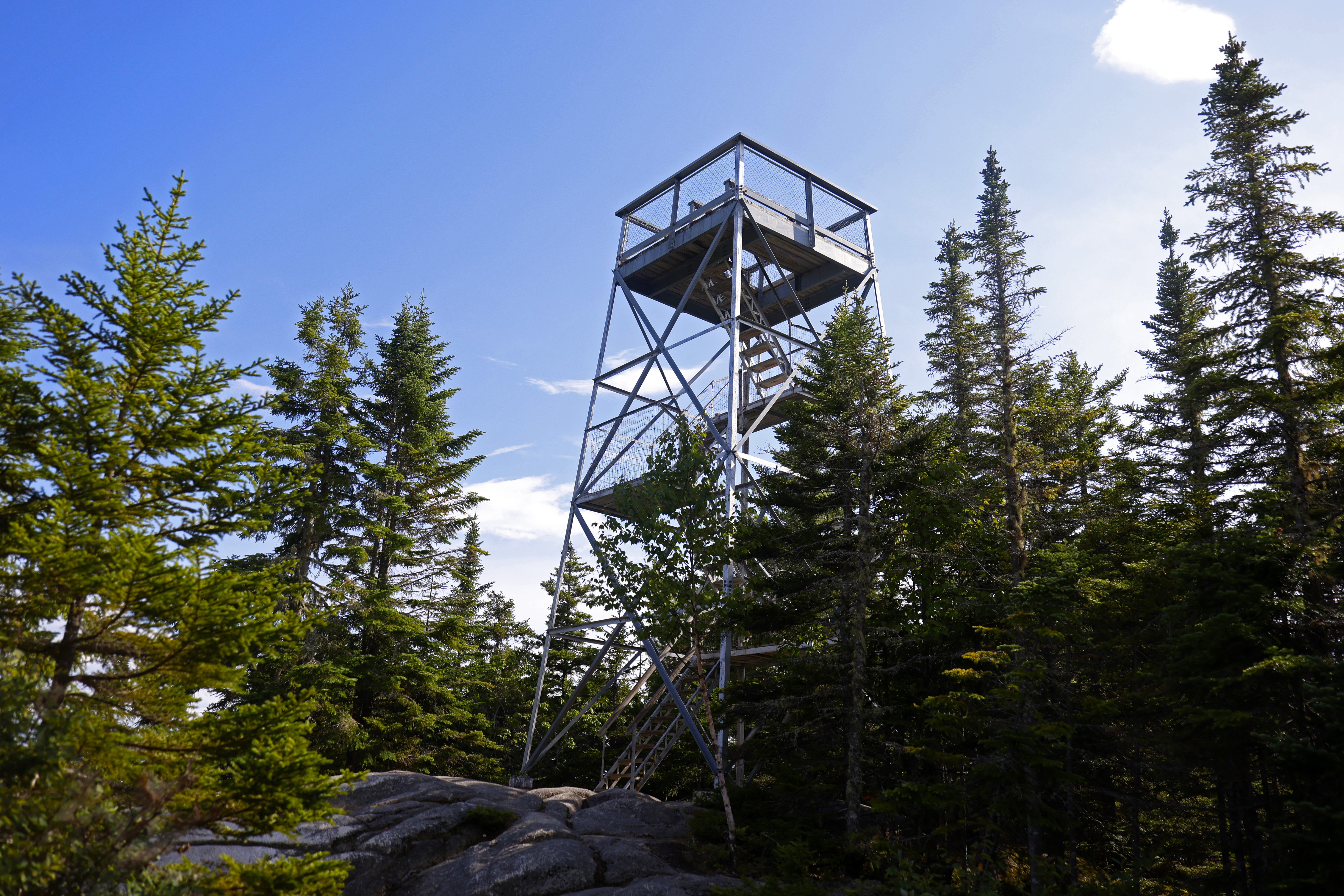
For those looking for a short, accessible hike, the Bald Mountain trail is a standout option. Two well-marked trailhead parking areas, one on Carry Road and the other shorter path on Bald Mountain Road, are only a few minutes outside of Oquossoc and about 15 minutes from Rangeley. One trail is 2.5 miles round trip and the other is 3.9 miles, linking up with the first trail about a mile in.
The hike itself starts out relatively flat, getting progressively steeper as you climb the western side of the mountain. As you get close to the top, the trail will have sections of rock scrambles. The hike itself takes around 30-60 minutes, but everyone hikes at their own pace, so be mindful of when you’re starting, and there’s no shame in turning around if you’re losing daylight or weather conditions change.
At the top, you’ll find your views obstructed by trees. Climb the metal lookout for a 360-degree view of Rangeley and Mooselookmeguntic lakes. You may need to wait your turn before climbing the tower. The top platform can be a bit cramped if you’re in a group. Be sure to watch your head on the way down the stairs; there is a low metal bar you could smack your head on if not paying attention.
Mount Blue — Weld
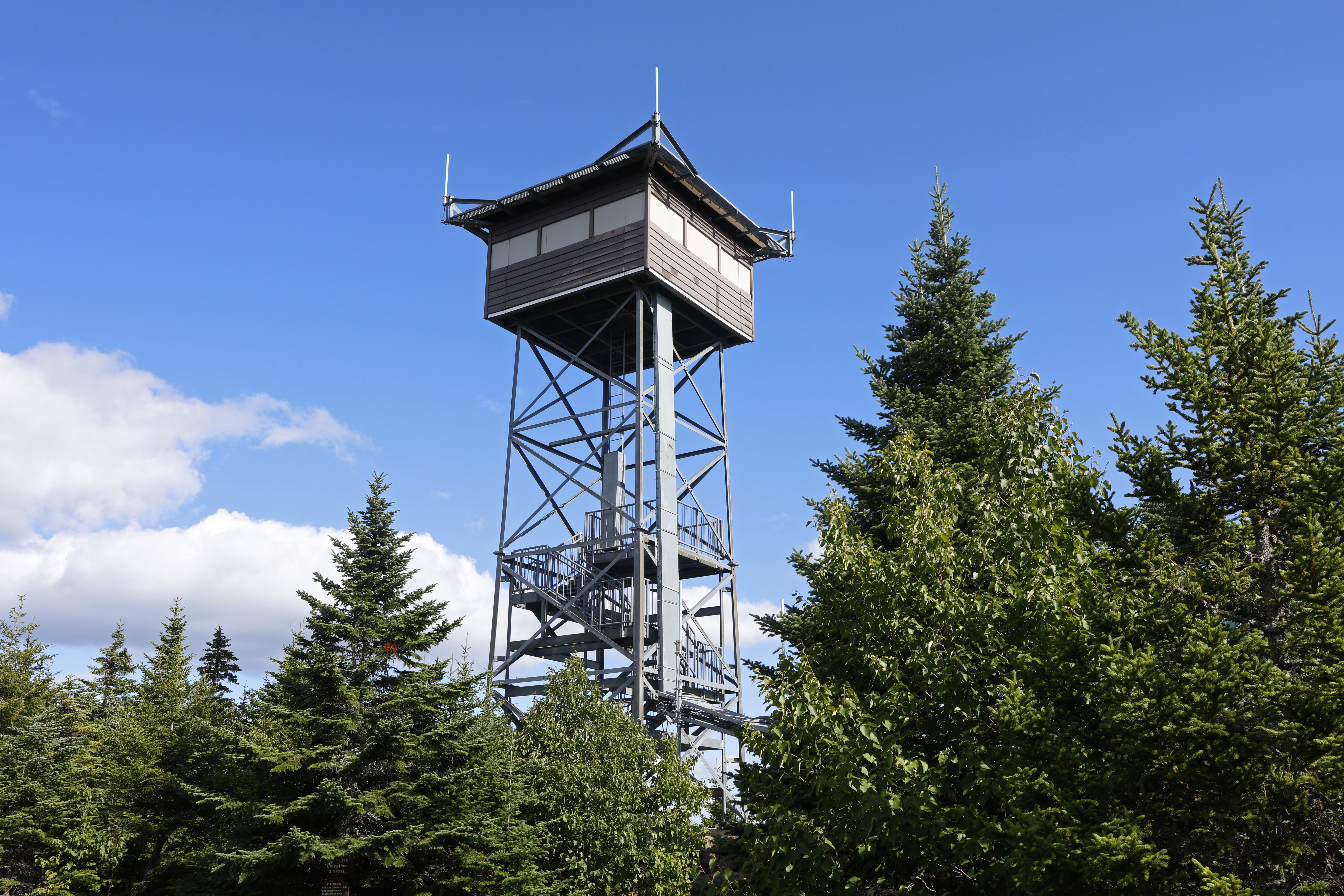
If you’re hoping for a hike where you’re likely to see other people on your route, a state park is always a busy option. Mount Blue State Park in Weld has its own fire tower that visitors can climb at the end of the trail.
Enter the park from Center Hill Road and continue driving until the road becomes gravel. Continue on until you start seeing signs for the Mount Blue trail. They will lead you to a 3-mile single-lane dirt road that takes you to the trailhead.
The trail is a climb from the start, so don’t expect any switchbacks or flat sections. It’s a 1.5-mile hike up to the top. The trail is popular, so you’re likely to see a friendly face or two along the way. Rocks litter the ground for the entire way up, so watch your footing, especially on your way down.
At the summit, you’ll find the fire tower, which is still used as a communication tower. You can’t climb to the top, but stairs allow you to climb halfway up for a sweeping view of the region.
Snow Mountain — northern Franklin County
This trailhead is around a 30-minute drive north on Route 27 from Eustis. From Route 27, also called The Arnold Trail, turn left onto N Road, a gravel road that you will follow for around 15 minutes. At the trailhead, you’ll find a grass parking area. The path starts up the road at a spot marked by two boulders.
This is a route that you’ll want mapped and saved ahead of time. The trail, 7.7 miles round trip, is clear for most sections, but it follows old logging roads, which have intersections that can easily become confusing if you’re not following a set route. Rock cairns and pink blazes tied to trees help to make the path clear.
In terms of the hike, the first 2 miles are flat with a manageable uphill climb, the second half follows older roads overgrown with tall grass (you’ll want pants and tall socks if you’re concerned about ticks). Moose droppings litter the last mile of trail, so be aware of your surroundings. Toward the top, the trail grows steep and blowdowns are constant, so you’ll be climbing over, under and around fallen trees.
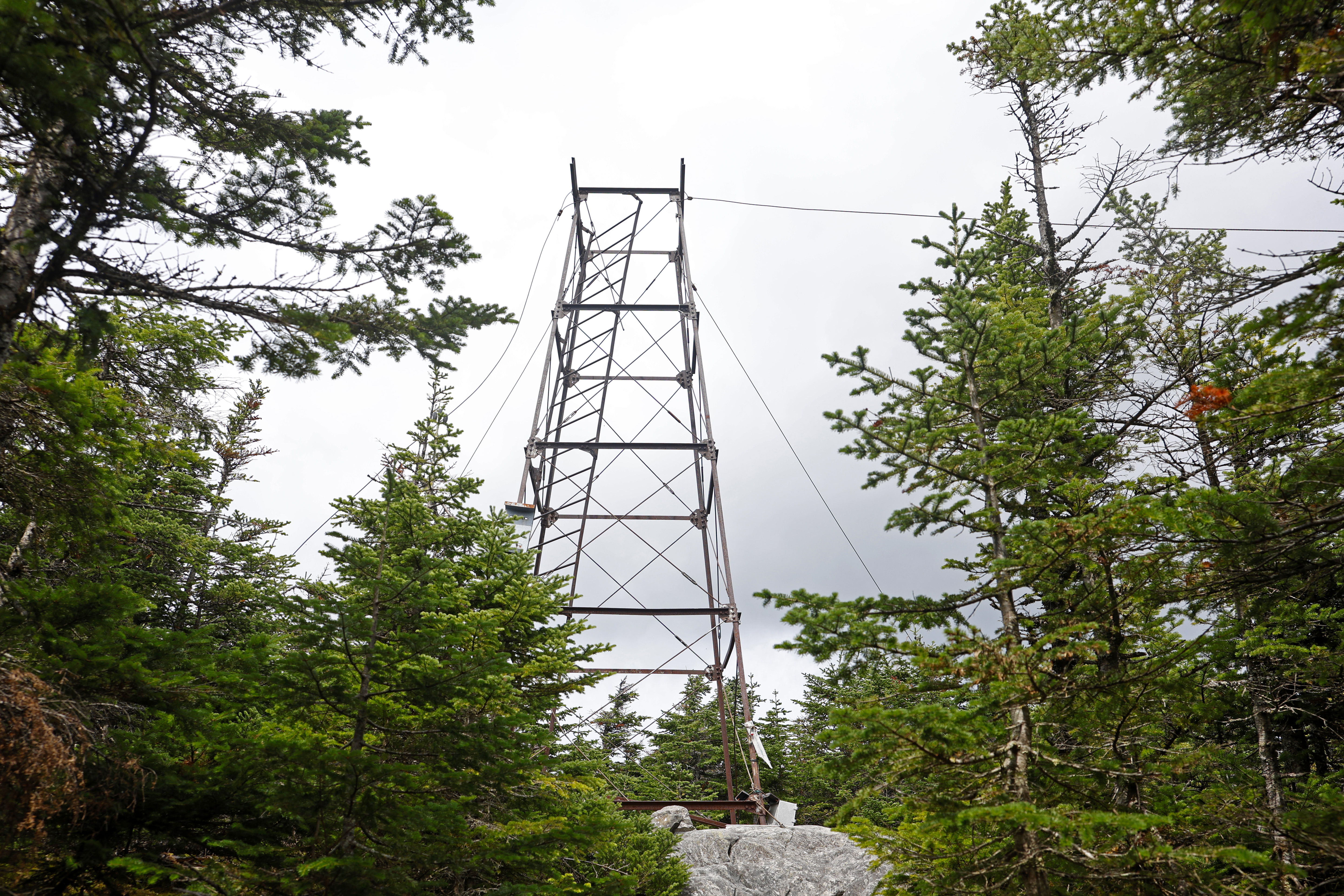
At the summit, you’ll find the skeleton of the old Snow Mountain fire tower. The ladder is still attached, so you can climb to the top if you’re brave. If you look in the trees behind the tower, you’ll find the smashed remains of the cab that once stood at the top.
Old Speck — northern Oxford County
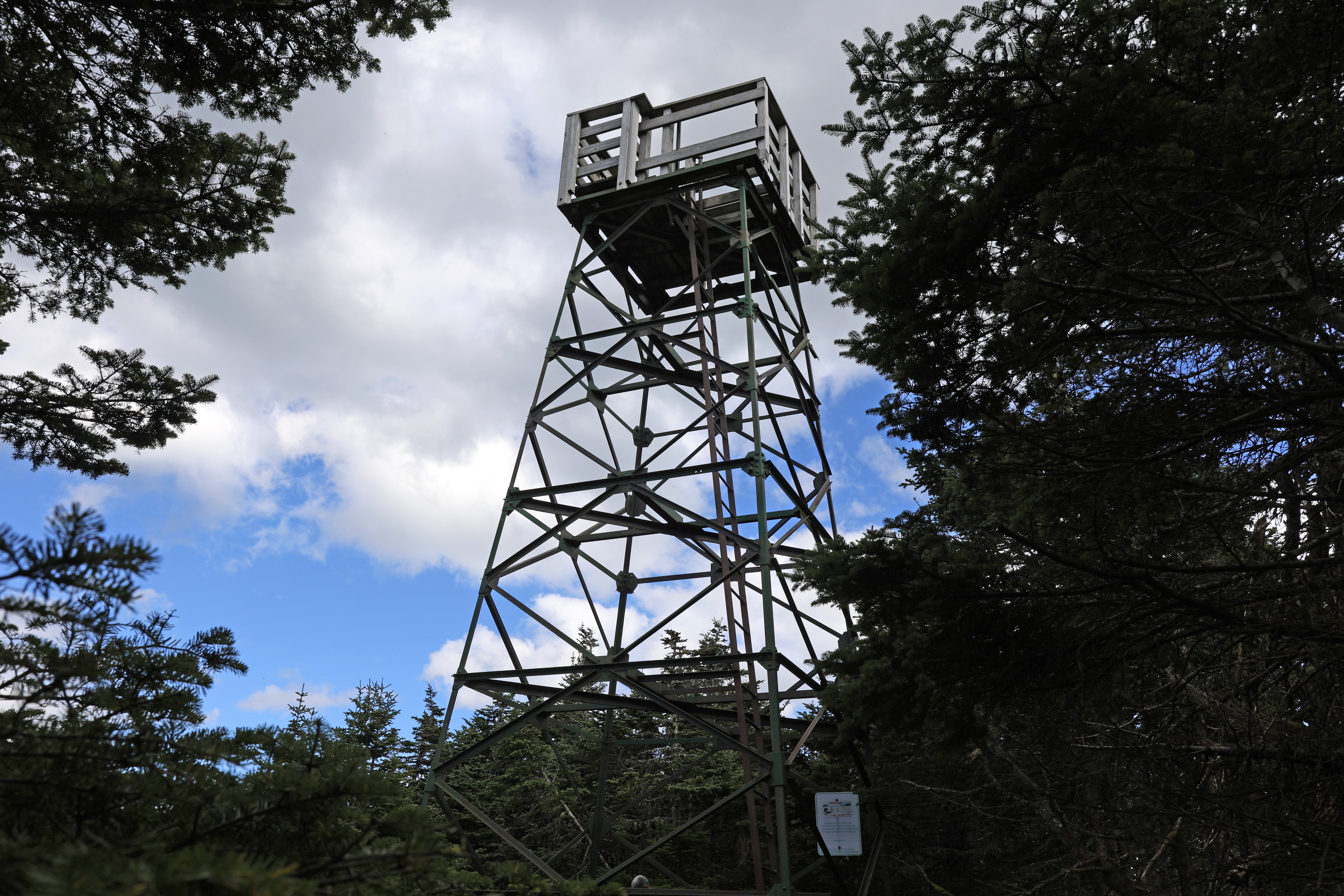
If the looming rock faces over the parking lot don’t make the mountain’s challenge clear, the steep, rocky climb from its base will. This 7-mile round trip, located in Grafton Notch State Park, has it all: small brook waterfalls (weather-dependent), plenty of wildlife and a rewarding view from the summit.
Even with rocks arranged to create some semblance of stairs up the first section of the hike, you may find your steam running out a bit early. Make sure you save some energy for the hike back down. It’s harder on your legs than the way up. After some time working your way up, down and up again, you’ll find yourself at a fork in the trail where you can take a spur trail to the fire tower, or continue on the Appalachian Trail. You want the Old Speck Trail.
The tower is one of the most stable of the bunch, with a ladder up to the top that is open to the public. From the tower, you can see Mount Washington and the Presidential Range across the state line in New Hampshire, Sunday River’s Whitecap Peak and Umbagog Lake.
Flagstaff Mountain — northwest Somerset County
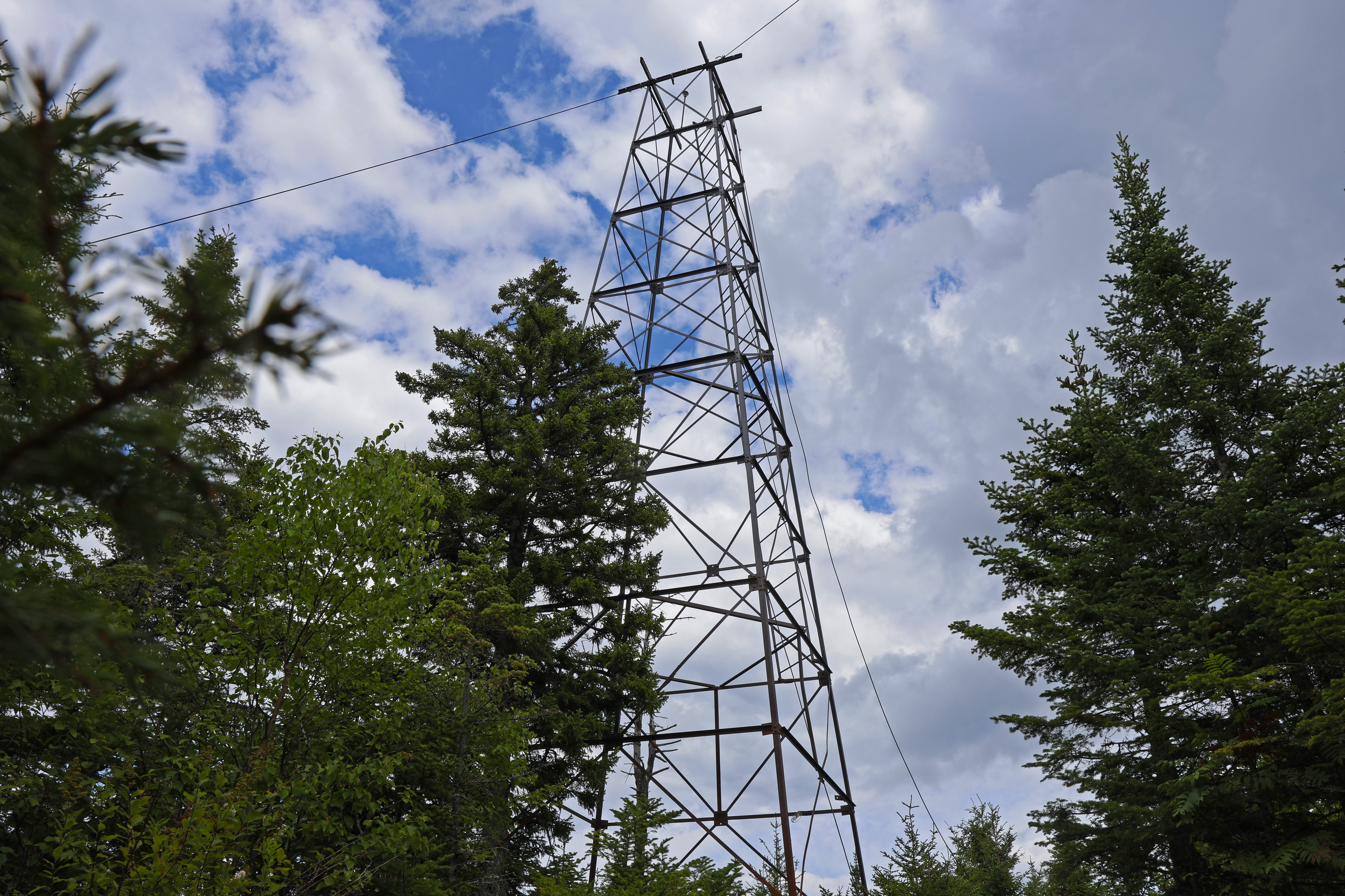
The retired fire tower overlooking Flagstaff Lake has seen better days. From the rusted and detached support cables to the 15 feet of ladder missing from the base of the structure, most people snap a photo from the bottom and keep moving. But from the ground, there isn’t too much to see beyond some views of the lake through the trees. That doesn’t stop some hikers from scaling their way up to the ladder.
This is a remote 4-mile round-trip hike. It is about a 45 minute drive from Stratton, 35 of which follow logging roads, so an off-road-capable vehicle is important. The trailhead is unmarked, so a navigation app like AllTrails is useful to find the start of the path. The trailhead is on a road that branches off from Long Falls Dam Road. Most vehicles won’t be able to make it up the half-mile route to the trail, so plan to park off the road at the intersection and hike in.
The trail itself is fairly overgrown. The path is wide, following what appears to be an old logging road, for the first half of the hike. About a mile into the route, the landscape gets rocky, so watch your footing. It’s a steady 2-mile climb to the top, where you’ll find the tower.

Supporting Sponsor for Franklin Journal, Livermore Falls Advertiser, Rangeley Highlander and Rumford Falls Times.
Keeping communities informed by supporting local news. franklinsavings.bank
We invite you to add your comments. We encourage a thoughtful exchange of ideas and information on this website. By joining the conversation, you are agreeing to our commenting policy and terms of use. More information is found on our FAQs. You can update your screen name on the member's center.
Comments are managed by our staff during regular business hours Monday through Friday as well as limited hours on Saturday and Sunday. Comments held for moderation outside of those hours may take longer to approve.
Join the Conversation
Please sign into your Sun Journal account to participate in conversations below. If you do not have an account, you can subscribe here. Questions? Please see our FAQs.